IVWGST Series.
World Earth Day.
The Northeast India region is one of the most active zones in the world; the region is jawed between the two arcs, the Himalayan arc to the north and the Indo-Burmese arc to the east. The region bounded by latitude 22-290N and longitude 90-980E, produced two great earthquakes (M> 8.0) and about 20 large earthquakes (7.0>M>8.0) since 1897. The Shillong Plateau was the source area for the 1897 great earthquake M 8.7, and the Assam Syntaxis zone for the 1950 great earthquake M 8.6. Several large earthquakes occurred along the Indo-Burma ranges. Earthquake is only natural disaster, which cannot be predicted till now and may occur at any time and pre-planned strategies for rescue of life and property are not possible and hence causes maximum devastation than other natural disaster. So, earthquake disaster mitigation and responses takes an important role to reduce the destruction of life and property. A mitigation strategy by CSIR NEIST-Jorhat is one of the prime concepts in order to reduce the hazard. This includes basic research on earthquake seismology based on the data accrued locally based on both standalone and VSAT local seismic networks.
Dense seismic arrays that record continuously have the potential to dramatically increase the resolution of subsurface imaging, and they can also be used to monitor micro-seismicity. However, the sensors that are used in these arrays usually lack the low-frequency response of conventional earthquake monitoring networks, and are often deployed at the surface in noisy environments. This presents challenges for extracting the signal from the noise. In CSIR NEIST-Jorhat (formerly RRL Jorhat), since 1982, the intensive seismic monitoring through standalone seismic network was being operational later upgraded to digital VSAT based monitoring system in the year 2006. A seismic network of 27 (twenty seven) unmanned VSAT based online / realtime high resolution seismic broadband stations covering entire 8 (eight) states of North East India called North East Wide Area Seismic Network (NEWSN) to intensify seismic monitoring on a real-time basis to observe the present seismicity and to understand the geodynamics of the region.
Densification of Broadband Seismic station, Strong Motion accelerograph, GPS station and Multiparamertic Geophysical observatory are being established which will farther resolute the principal techniques to be used in North-eastern India. earthquake seismology in more effectively.
The division publishes the Annual Seismological Bulletin and maintains the Seismic Database for NE India. Publication of yearly seismological bulletin by CSIR NEIST since 1982 has been the source of many research publications and research problems pertaining to Ph D thesis.
The division also provides routine update on earthquake hazard related information through our institutional webpage and issues near real-time mail notification.
Seismic vulnerability assessment of the populated cities & urban areas in NE India is another major program of the division. The division has initiated work for hazard-risk-vulnerability assessment of Shillong and greater Guwahati on priority basis.
Estimation of expected earthquake ground motion parameters is the main aim of seismic microzonation. Microzonation maps provide basic inputs for designing new infrastructure or retro-fitting of the existing ones. So far the division has completed the Phase – I microzonation of greater Guwahati and Agartala cities.
The Division also taken up a scenario development program where government engineers, architects and geologists were given hands on training on rapid visual screening through which school/college buildings and public halls, hospitals and other lifeline structures were examined based on civil design & building typology, age of construction, geological locations (vicinity of active faults) and rock types etc so that necessary retrofitting designs can be applied to minimize the risk associated.
In association with NDMA and SDMA’s the division also tries to assess multi – state earthquake disaster preparedness and evaluate the State/District Disaster Management Plans with an aim to identify gaps and generate the greater level of awareness in community about the seismic vulnerability of the region pertaining to high magnitude earthquake for risk reduction. Also it tries to generate awareness amongst the stakeholders and community about an earthquake of high magnitude and to facilitate inter-departmental and inter-state coordination in order to ensure organized and structured mechanism during the time of disaster.
Since last two decades, the Division is carrying out numbers of Internationally collaborative projects. Presently, intensive collaboration with Institute like, Institute of Physics Earth, Moscow, Earth Observatory of Singapore, Singapore, Strasbourg University, France and NORSAR, Norway are going on pertaining to various Seismological and Tecto-Geodynamics of North Eastern India.
The division actively participated in the 18th Indian Scientific Expedition to Antarctica to carry out projects related to Earth Sciences as wintering over.
Mandate of the Division
Vision and Mission

Education : M.Tech (Applied Geology), Ph.D (Geomorphology)
Employee ID: ID No. 1113
Email: manojphukan06@gmail.com, manojkphukan@neist.res.in
Phone: +91-0376-2370114
Fax: 0376-2370011
Area of Interest: Fluvial Geomorphology, Neo-tectonics

Education : M.Tech (Applied Geology), Ph.D
Employee ID: ID No. 1111
Email: sangees_online@rediffmail.com, sangeeta@neist.res.in
Phone: +91-0376-2370114
Fax: 0376-2370011
Area of Interest: Geomorphology, Neo-tectonics, Seismic Microzonation

Education : M.Sc. (Geology); M.Tech (Computational Seismology); Ph.D (Seismology)
Employee ID: ID No. 1122
Email: bijit4u@gmail.com, bijit@neist.res.in
Phone: +91-0376-2370114
Fax: 0376-2370011
Area of Interest: Seismology (Seismic Tomography, Seismic Wave Attenuation, Geodynamics)
Personal Webpage

Education : M.Sc. (Physics), Ph.D. (Seismology)
Employee ID: ID No. 1234
Email: santanub27@gmail.com, santanu@neist.res.in
Phone: +91-0376-2370114
Fax: 0376-2370011
Area of Interest: Seismic Source Characterization, Tectonic Stress Field Analysis, Seismic Anisotropy, Ambient Noise Tomography, Earthquake Precursors

Education : Ph.D (Seismology), IIT Kharagpur
Employee ID: ID No. 1277
Email: debasis@neist.res.in; devlinkan@gmail.com; debasis06@iitkgp.ernet.in
Phone: +91-0376-2370114
Fax: 0376-2370011
Area of Interest: Seismology and Structure, Seismic Tomography, Tectonics and Geodynamics, Seismic Anisotropy, Integrated Geophysics personal website
Education : B.Sc
Employee ID: ID No. 995
Email: duttap@neist.res.in
Phone: +91-0376-2370114
Fax: 0376-2370011
Area of Interest: Seismology

Education : B.E. (ECE)
Employee ID: ID No. 1166
Email: sausthov@neist.res.in
Phone: +91-0376-2370114
Fax: +91-0376-2370011
Area of Interest: Geophysical Instrumentation
Ongoing R&D program of the Division:
On-line/ Real-time Seismic Network for Disaster Mitigation in N E India:
Seismic Network of 27 High Resolution Broadband, Remote Unmanned observatories covering entire NE India

Central Recording Station (CRS) with High Performance Computing (HPC) for simultaneous processing of data, Event location and Real-time Seismic Bulletin.
Site specific seismic Investigation:
The division has taken up several consultancy projects for detailed
seismotectonic investigations. Adopting appropriate design for construction
of Mega Dam to mitigate any future hazard related to reservoir induced seismicity
becomes very much essential from the societal point of view. The division has taken
up no. of projects where a study on detailed background seismicity has been carried out.
Seismic Microzonation
Microzonation maps provides basic inputs for designing new infrastructure or recto-fitting
of the existing ones. So far the division has completed the Phase – I microzonation of greater
Guwahati, Agartala and Shillong city.
Seismic Network of 27 High Resolution Broadband, Remote Unmanned observatories covering entire NE India
Earthquake Scenario : The North Eastern states lie in the highest seismic zone -V. Keeping in view of Shillong, Meghalaya Earthquake of magnitude 8.7 of June 12, 1897 which had devastated the entire Shillong plateau and affected the whole of northeast India, the Division in support from NDMA had initiated the Earthquake Scenario exercise to create greater awareness if similar event recur in the region in near future.
Multi Parametric Geophysical Observatory (MPGO) The division in support from Ministry of Earth Sciences (MoES) has established a Multi Parametric Geophysical Observatory (MPGO) where different geophysical parameters will be monitored continuously for identifying the Earthquake precursory phenomena.
Significant R&D Achievements Hazard Assessment Findings Present probabilistic seismic hazard approaches (PSHA) widely used in the earthquake engineering community. A robust and shared validation of the available numerical procedures for assessing seismic hazard, computing earthquake probabilities and calculating ground shaking scenarios have been carried forward for two most populous cities of Northeatsern India (Pure Appl. Geophys. 2013 Springer Basel, DOI 10.1007/s00024-012-0631-0), Geomatics and Natural Hazards and Risks ( July 2011), doi : 10.1080/19475705.2011.568070)
Earthquake source inversion and high-frequency rupture imaging provide time-dependent information on earthquake rupture processes, but a synoptic view of the origin and impact of the resulting uncertainties on the estimated source parameters has not been fully developed. Furthermore, the optimal integration of various datasets, and the combination of source inversion and source imaging, to derive a complete understanding of the kinematic rupture evolution in space and time, still pose many open questions. In this context, a reliable near-real-time finite-fault parameter estimation are tried with high-fidelity rupture-history inversions to help build more realistic dynamic models of the earthquake rupture process in North-eastern India (Bulletin of the Seismological Society of America, Vol. 103, No. 1, pp. –, February 2013, doi: 10.1785/0120120095(IF=1.8) DCS-DST NEWS DST, Govt. of India, August 2012, Pg no. 5-9). Seismicity has fractal structures with respect to time, space and magnitude. The Gutenberg-Richter relation means that there is no characteristics fracture size and that size-distribution has a self similar property. Based on the available data the fractal dimension analysis in Northeastern India have been tried through various publication in CSIR NEIST-Jorhat.( Pure Applied Geophysics (IF=1.1), DOI 10.1007/s00024-012-0465-9, 10th April, 2012, 2010 Birkha¨user / Springer Basel AG DOI 10.1007/s00024-010-0084-2, Pure and Applied Geophysics, 2010.
With advent of digital waveform, here innovations and advances in 3D travel time tomography, waveform tomography, surface wave inversion, joint inversion, stress inversion of multiple geophysical observations are being carried out and extentive study was made through imaging. (Science and Culture, Vol. 77, No. 11-12, PP 480-485, Nov-Dec 2011, Tectonophysics 532–535 (2012) 186–192 (IF=2.5), Bull. Seismological Society of America, 8th August, 2012, Volume 103, Issue 2a, DOI. doi: 10.1785/0120110354, Geophy. J. Int. 178, 303-326, 2009.
The earthquake magnitude estimate is a routine task in all seismological observatories. Several magnitude scales are available, based on amplitude measurement of different seismic phases, and/or on total signal duration. Among them, the duration magnitude (MD) is adopted in many regional networks because it provides a rapid and reliable estimate of the earthquake size through a fairly simple procedure based on the measure of the duration of recorded seismograms. The duration magnitude is defined as MD determined through a regression analysis. Calibration of duration magnitude scale for the area monitored by the different Seismic Network in North-eastern has been carried out for more than 30 seismic stations.
(J. Geol. Soc India, 70, pp 323-338, 2007)
Microearthquake networks are especially well suited for intensively studying seismically active areas and are a powerful tool for investigating the earthquake process in great detail and in relatively short time intervals. Their applications are numerous, such as monitoring seismicity for earthquake prediction purposes, mapping active faults for hazard evaluation, and investigating the Earth's crust and mantle structure. Utilizing the microseismicity analysis some of the features related to prediction of an impending earthquake, usually on the basis of the observation of a precursory signal may be made. The prediction would still be probabilistic, in the sense that the precise magnitude, time and location might not be given precisely or reliably, but that there is some physical connection above the level of chance between the observation of a precursor and the subsequent event. Forecasting would also have to include a precise statement of the probabilities and errors involved, and would have to demonstrate more predictability than the clustering referred to in time-dependent hazard. The practical utility of this would be to enable the relevant authorities to prepare for an impending event on a timescale of months to weeks. Practical difficulties include identifying reliable, unambiguous precursor and the acceptance of an inherent proportion of missed events or false alarms, involving evacuation for up to several months at a time, resulting in a loss of public confidence. Lots of effort is needed towards this aspect to be more effective for precursory study. In this regard low b value prior to the Indo-Myanmar subduction zone earthquakes and precursory swarm before the occurrence of large earthquake ( Journal of Asian Earth Sciences, 73(2013), 176-183).
The prime requirement for studying earthquake seismology is the development of accurate seismicity catalogue. A new updated catalogue has been prepared for NE India with more local, and lower magnitudes.
GPS to measure plate boundary deformation based on “campaign style” measurements, where only a few days of data were collected each year. In this mapping GPS receivers have been used to estimate the strain rate in the crustal domain underneath in Northeastern India under various campaign mode.
Site effects on strong ground motions include the effects of surface and sub-surface topography, stratigraphic discontinuities, and soil layering besides estimation of ground motion parameters. These three-dimensional (3D) effects are known to affect the amplitude, frequency and duration of ground motion through mechanisms of ground response (including impedance and resonance effects) which are studied characterizing the most populous city in North eastern India ie. Guwahati and Shillong city.Strong ground motion parameters for the Guwahati city area, the capital city of the state of Assam in northeast India, are examined with the help of data accrued from local as well as worldwide network. Empirical relations are proposed for the ground motion parameters as a function of earthquake magnitude, distance, fault type, source depth and velocitycharacteristics ofmedium. Seismotectonics of the study region is examined ,and a maximum credible earthquake MS* 8.0 is presumed from the Brahmaputra fault, the nearest source zone in the city area. Such great/major event may cause intensity of the of 9.3 with a probability of 0,95 in the Guwahati city during time interval of 500 years. Further, the design spectrum with 67 % confidence level and the synthetic three-component accelerograms are constructed. These results are much relevant and useful for structural engineering to mitigate seismic hazards in the region.( Bulletin of the Seismological Soceity of America; October 2011; v. +101; no. 5, pp 2550-2560; DOI 10.1785/0120100207, Current Science, Vol. 99, No. 6, 25 September 2010.
Hazards like earthquakes are natural, disasters are not. Disasters result from the impact of a hazard on a vulnerable system or society at a specific location. The framework of vulnerability aims at a holistic concept taking physical, environmental or socio-economic components into account. Study focuses on the physical dimension of vulnerability for the complex urban system of capital city Shillong, India. Most importantly emphasis are given to geomorphology, geology, besides seismotectonic features. An urban land cover classification based on high resolution satellite data establishes the basis to analyse the spatial distribution of different types of buildings, the carrying capacity of the street network or the identification of open spaces. In addition, a DEM (Digital Elevation Model) is the basis to calculate slope map that enables localization of potential landslide areas. A methodology to combine these attributes related to the physical dimension of vulnerability is presented. In this process an n-dimensional coordinate system plots the variables describing vulnerability against each other. This enables identification of the degree of vulnerability and the vulnerability-determining factors with subject to a specific location. This assessment of vulnerability provides a broad spatial information basis for decision-makers to develop mitigation strategies. CSIR NEIST Jorhat has taken intense initiative towards this aspect.
The northwestern trending lithotectonic units of the Mishmi block are juxtaposed with the almost N-S trending eastern Himalayan lithotectonic units along the Siang fracture. Earthquakes occurring on the Indian peninsula are the outcome of the Indian plate under thrust towards the Eurasian continent. A large window in the Siang river section exposes Paleocene rocks interbeded with Abhor volcanic as the subthrust package and MBT as the roof thrust. Mishmi block, tectonically separates the eastern Himalayan and the Indo-Myanmar mobile belts and form ‘a linkage’ in between. Active faulting along the Himalayan Front is observed. Left-lateral strike slip faults displacing Mishmi Thrust Zone had been observed. Morphological and sedimentary records at Siang, Dibang and Lohit rivers at Pasighat, Dambuk, Roing, Tezu and Parsuramkund areas in the NE Himalaya were studied with the help of terraces, for the evidences of the climate-tectonic interplay. Drainage maps were prepared and structurally controlled drainages were observed in the study area. Mishmi Thrust zone is found to be tectonically active with the uplifting of the Quaternary fluvial sediments for a height of about 40m from the present day river channel.
Tectonic stress regime in the Shillong plateau, northeast region of India, is examined by stress tensor inversion. Some 97 reliable fault plane solutions are used for stress inversion by the Michael and Gauss methods. Although an overall NNW-SSE compressional stress is observed in the area, the stress regime varies from western part to eastern part of the plateau. The eastern part of the plateau is dominated by NNE-SSW compression and the western part by NNW-SSE compression. The NNW-SSE compression in the western part may be due to the tectonic loading induced by the Himalayan orogeny in the north, and the NNE-SSW compression in the eastern part may be attributed to the influence of oblique convergence of the Indian plate beneath the Indo-Burma ranges. Further, Gravitational Potential Energy (GPE) derived stress also indicates a variation from west to east
(Physics and Chemistry of the Earth(2015 ; 1-14)
Research Facilities available in the Division
Existing Equipments:
Equipments under procurement:
Radon and Helium monitoring device, Overhauser magnetometer, Fluxgate magnetometer, ULF-VLF
measurement device, Magneto telluric, Resistivity, GPS, Accelerograph and BB seismograph &
others related equipments for Multi-parametric Geophysical Observatory
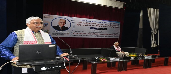
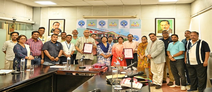
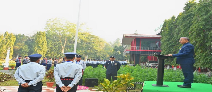
Explore moments and highlights from various events, activities, and milestones at CSIR-NEIST through our gallery.